The Future of UK Letters: Heading for Extinction or Evolution?
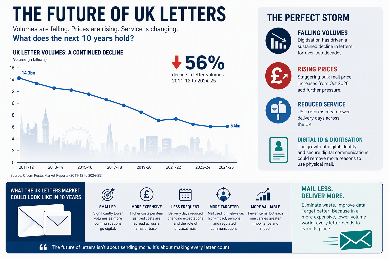
In March 2025, Denmark made headlines by announcing the end of its national letter delivery service from the end of 2025. For many in the postal and communications industry, it felt like a glimpse into the future. Letter volumes in Denmark had collapsed by more than 90% since the turn of the century as consumers and businesses embraced digital communications. Looking at the UK market today, it is difficult not to notice some uncomfortable similarities. Letter volumes continue to decline, Royal Mail is implementing major Universal Service Obligation (USO) reforms that reduce delivery frequency, and significant price increases are being introduced for bulk mail users from October 2026. Against that backdrop, an obvious question emerges: Will the UK letters market [...]